




JUBA, South Sudan – South Sudan Vice President Taban Deng Gai has renewed tensions over the disputed Ilemi Triangle, challenging Kenya’s administration of the approximately 14,000-square-kilometre territory and calling for its status to remain subject to discussions between the two countries.
Deng Gai raised the issue during a Cabinet meeting in Juba on August 29, 2026, while reviewing a map of East Africa’s boundaries.
The Vice President expressed dissatisfaction with the map, arguing that it failed to accurately represent areas that South Sudan considers part of its territory.
Taban rejects map showing disputed territories
Deng Gai said the map presented to him had excluded several areas that he believes belong to South Sudan.
“That section, it is the land of South Sudan. Now the Kenyans are almost agreeing on taking Ilemi,” Deng Gai said.
He also referred to areas he identified as Kafia Kingi and Horfart an Hasa, arguing that they had been left out of the map despite South Sudan considering them part of its territory.
“The two horns of the bull, one in the eastern area of the Western Bahr el Ghazal should not be there. Horfart an Hasa and Kafia Kingi of our territory have also been cut out by the Kenyan Government,” he said.
The Vice President characterised the issue as more than a cartographic disagreement, calling for what he considers inaccurate representations of South Sudan’s territorial boundaries to be corrected.
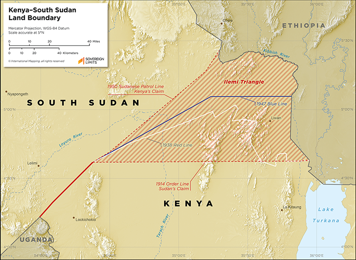
South Sudan challenges Kenya’s administration of Ilemi Triangle
Deng Gai then focused on the Ilemi Triangle, a remote and largely arid territory bordering Kenya, South Sudan and Ethiopia.
The territory has remained disputed for decades, with Kenya exercising effective administration and security control while South Sudan maintains a claim over the area.
Deng Gai argued that the Ilemi Triangle should not be treated as territory whose status has been conclusively settled.
Instead, he said it should continue to be recognised as an issue requiring discussion between Kenya and South Sudan.
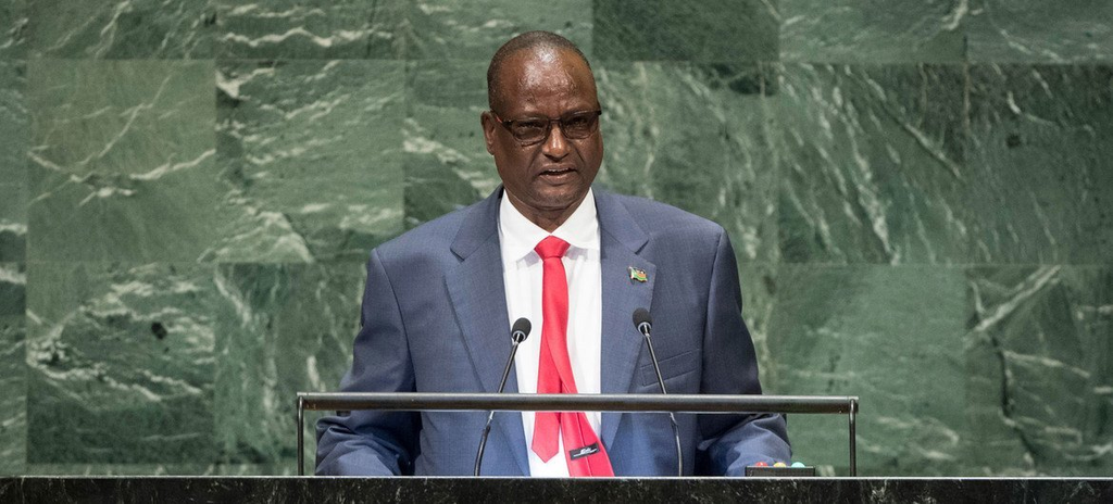
Deng Gai recalls Moi-era map controversy
The South Sudanese Vice President also referred to Kenya’s political history while explaining his position on the dispute.
He recalled an episode involving former President Daniel arap Moi, alleging that Moi had altered Kenya’s map to include the Ilemi Triangle at a time when South Sudan was still part of Sudan and was experiencing conflict.
“I remember one evening, one midday, late President arap Moi decided to change the map of Kenya to include the Ilemi Triangle,” Deng Gai said.
He argued that conflict within a country should not provide a basis for another country to take control of its territory.
“Those of Raila Odinga went protesting because you cannot annex the land of our brothers because they are in war,” he added.
The account reflects South Sudan’s longstanding position that Kenya’s administration of the territory should not be interpreted as establishing undisputed sovereignty.
Why the Ilemi Triangle is disputed
The Ilemi Triangle covers roughly 14,000 square kilometres and lies in a remote border region where the boundaries of Kenya, South Sudan and Ethiopia have historically been difficult to administer.
Kenya has exercised effective control over the territory and maintains security operations in the area. Its position has been linked partly to the need to protect Turkana pastoralists, who rely on the territory for grazing and water.
South Sudan inherited territorial claims previously held by Sudan following its independence in 2011. South Sudanese officials have periodically challenged Kenya’s administration and maintained that the territory forms part of South Sudan.
Ethiopia is also geographically connected to the area, although it does not maintain the same formal territorial claim. Communities including the Dassanech and Nyangatom regularly move across the border in search of pasture and water.
Pastoral communities complicate border dispute
The territorial question is closely connected to the movement of pastoral communities across borders.
Turkana communities from Kenya, alongside groups including the Toposa, Didinga, Dassanech and Nyangatom, use grazing areas and water sources around the wider border region.
Competition over increasingly scarce resources has contributed to recurring tensions and clashes between communities.
This makes the Ilemi Triangle more than a question of maps and territorial claims. Control of the area also affects access to pasture, water, security and the movement of pastoral populations.